
Model Design of the Mine Drainage System Kaolin Mining Site
Djawani Gunung Abadi, Trenggalek Regency, East Java Province
Avellyn Shinthya Sari
a
, Yudho Dwi Galih Cahyono
b
, Eka Putra Yolendra, Yazid Fanani,
Esthi Kusdarini
c
and Fairus Atika Redanto
Mining Engineering Department, Institut Teknologi Adhi Tama Surabaya,
Jl. Arief Rachman Hakim 100, Surabaya, East Java, Indonesia
Keywords: Mining, Mine Drainage, Design.
Abstract: Mining drainage is aimed at minimizing water entering the front mining as well as removing water from the
mining front area. Djawani Gunung Abadi Ltd is one of the companies engaged in the mining industry kaolin
is located in Karangan District, Trenggalek Regency, East Java Province. This research was conducted with
the aim of designing a mine drainage system at Djawani Gunung Abadi Ltd so that water does not enter the
mining sites. From the results of the research and discussion carried out, a large amount of. The total water
discharge entering the mine site is 0.55 m
3
/second with an area rain catch of 19 Ha and bottom pit area of
6,046 Ha. Calculation of capacity the open channel is the width of the upper surface of the channel (B) of 1.1
m; channel base width (b) by 0.48 m; channel height (d) of 0.97 m; water depth (h) of 0.48 m; Tall guard (w)
of 0.49 m; channel slope by 2%; by channel wall coefficient (n) of 0.045; resulting in an open channel
reservoir capacity of 0.55 m
3
/s with a settling pond capacity of 2,500 m
3
.
1 INTRODUCTION
Be advised that papers in a technically unsuitable
form will be returned for retyping. After returned the
manuscript must be appropriately modified. Mining
drainage is one of the important aspects of open pit
mining related to working conditions, safety,
productivity and the environment where mine jetting
aims to minimize water entering the mining front and
remove water from the mining front area. The
company's mining system that applies this quarry
method, whose entire activity is directly related to
weather and climate, causes the mining front to come
face to face with water from rain and runoff water,
high rainfall can affect and even hinder mining
operations.
PT. Djawani Gunung Abadi is one of the
companies engaged in the Kaolin mining industry
located in Karangan District, Trenggalek Regency,
East Java Province. During mining activities, this
company does not yet have mining activities so that
a
https://orcid.org/0009-0009-5132-0040
b
https://orcid.org/0000-0001-6249-5967
c
https://orcid.org/0000-0002-7719-5614
during the rainy season the usual problem is the
presence of rainwater entering the mining site. When
there is high rainfall, the water from rainwater will
inundate the mining area which causes the mining site
to be muddy.
2 CASE STUDY AND
DESCRIPTION
Djawani Gunung Abadi Ltd is located in Trenggalek
Region, with the address National III Buluagung
street, Karangan District, Trenggalek Regency, East
Java Province. To reach the territory of PT. Djawani
Gunung Abadi, which is located in Ngentrong
Village, Karangan District, can be reached by using
the 7-land route. With a total time taken 4 hours 15
minutes do not use rest.
Sari, A., Cahyono, Y., Yolendra, E., Fanani, Y., Kusdarini, E. and Redanto, F.
Model Design of the Mine Drainage System Kaolin Mining Site Djawani Gunung Abadi, Trenggalek Regency, East Java Province.
DOI: 10.5220/0012108100003680
In Proceedings of the 4th International Conference on Advanced Engineering and Technology (ICATECH 2023), pages 331-335
ISBN: 978-989-758-663-7; ISSN: 2975-948X
Copyright
c
2023 by SCITEPRESS – Science and Technology Publications, Lda. Under CC license (CC BY-NC-ND 4.0)
331
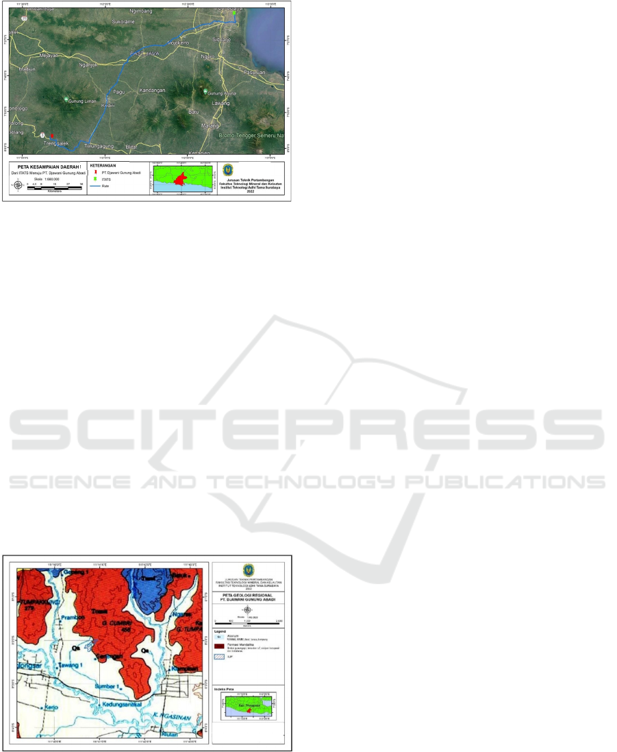
Figure 1: Map of Research Location.
2.1 Local Geology
Tectonically, the Southern mountainous zone of Java
is a magmatic arc formed from the results of the
support activities of the Indian Plate - Australia and
the Asian Plate in the Late Oligocene - early Miocene.
This magmatic size stretches from west to east along
Java Island. The geological structures found in the
investigation area are minor stocky due to loading and
processing of larger geological structures. The strike
direction of the rock layer is generally relatively
West–East direction i.e. N 100º E, with a dip slope
between 15º. The research site is included in 2 (two)
rock formations, namely the Mandalika 8 (Tomm)
Formation which is composed of interspersions of
volcanic brection, lava and tuff, sided with tufan
sandstones, siltstones and clay rocks of late
Oligocene to Early Miocene age and Alluvium
Formation (Qa) composed of tholocene-aged keracal,
gravel, silt, and clay.
Figure 2: Geological Map Research Area.
3 METHODOLOGY
Djawani Gunung Abadi Ltd is located in Trenggalek
Region, with the address National III Buluagung
street, Karangan District, Trenggalek
Several methods of collecting information or
data were used in this study to gain a thorough
understanding of the subject matter that was the
focus of the investigation. The authors collected
information using primary data and secondary data,
two separate data collection methods. While primary
data is information collected from the actual field,
secondary data is information collected through
bookkeeping and companies. The author then uses
this information to help with troubleshooting.
3.1 Primary Data
Primary data is information collected by taking or
measuring directly in the field. The following are the
study's key findings:
● Rainfall data
Rainfall data is obtained from data from the
Central Statistics Agency and then used as data
for calculating rainfall plans so that water
discharge values are obtained. The rainfall data
used is data for the last 10 years so that
planning and analyzing rainfall plans is easier
and more accurate.
3.2 Secondary Data
Secondary data is information that has been
collected from sources other than the field, such as
literature or companies. In this study, the secondary
data were:
● Topographic map
Topographic Maps are obtained from the company.
Where this map is used by researchers to determine
the area of the catchment area.
● Geological map
Geological maps are obtained from the literature.
Where this map is used to find out the lithology or
rock layer at the research site so that it can be known
the possibility of rock layers becoming aquifers or
the possibility of groundwater.
● Land use map
Land use maps are obtained from the company or
from the web literature of the spatial plan and the
trenggalek regency. Where this map is used to help
determine the runoff coefficient.
● Map of the mine situation
MAP OF RESEARCH LOCATION
Legend
Map Indeks
Geological Map
ICATECH 2023 - International Conference on Advanced Engineering and Technology
332

A map of the mine situation was obtained from the
company. Where this map is used to find out the
conditions or situation at the mining site so that it
can determine the placement of open channels and
the location of the settling pond correctly.
3.3 Data Collection Methods
Researchers need a variety of supporting data to
support the need to research this research data. The
data retrieval method used is modified according to
the type of data collected as follows:
● Literature study
A literature study is a search for library resources
on the issues to be addressed in the study, including
information from journals, books, internet sources,
and library databases.
● Research data collection
The implementation of this research utilizes
various information collection techniques in an
effort to gain a general understanding of the subject
of the research focus. The authors used primary data
and secondary data, two different data retrieval
techniques, to collect information. Primary data
comes directly from the field. Secondary data, on the
other hand, comes from business and literature. For
the author's approach to problem solving, he uses
both techniques.
3.4 Data Analysis Techniques
After data collection, the next step is to organize the
collected data into groups for analysis. The
following data should be checked:
● Calculating rainfall plan
Then the rainfall data obtained is calculated with
the help of Microsoft Excel.
𝐶𝐻𝑅 𝑋
𝑠
𝑆𝑛
𝑌𝑡 𝑌𝑛
● Calculating rainfall intensity
To calculate the intensity of precipitation using
the Mononobe calculation formula below.
𝐼
𝑅
24
24
𝑡
● Determine area of catchment area
the determination uses Arcgis 10.4 and Surpac
6.3 software to determine the catchment area based
on the catchment area that is expected to be a
watershed. Topographic maps are used to calculate
measurements in the mining area of Djawani
Gunung Abadi ltd.
● Calculating runoff water discharge
𝑄 0,278 𝐶 𝐼 𝐴
● Calculating open channel dimensions
Makes use of a trapezoidal cross-section to
determine the size of an open channel. Discharges
affecting the design of open channels are taken into
account when calculating the dimensions of open
channels.
● Calculating settling pond dimensions
To determine the dimensions of the settling pond
is adjusted to the pumping discharge and the volume
of rain runoff. Where the determination of the
dimensions of this settling pond is based on the
Ministry of Energy and Mineral Resources 1827 K /
MEM / 30/2018 concerning Good Mining
Engineering Rules.
Figure 3: Map of Djawani Gunung Abadi Ltd Area Water
Flow Direction.
Table 1: Rock strata properties.
Tilt Land cover / type
Runoff
coefficient
(C)
Rice fields, forests,
swamps
0,2
<3% (Flat) Plantation 0,3
Housing
0,4
Forests, plantations 0,4
3% -15%
Housing, 0,5
(Moderate)
The bushes are
rather s
p
arse,
0,6
Map Indeks
GROUND WATER FLOW
MAPS
Road
River
Contour Indeks
Contour
Research Location
Groundwater flow
Model Design of the Mine Drainage System Kaolin Mining Site Djawani Gunung Abadi, Trenggalek Regency, East Java Province
333

Table 1(continued): Rock strata properties.
Open field 0,7
Forest, 0,6
> 15%
Housing, 0,7
(Steep)
The bush is a bit
s
p
arse
0,8
Open land in the
mine area
0,9
4 RESULT AND ANALYSIS
Data on rainfall and rainy days used as mine drainage
analysis were obtained at the Central Statistics
Agency of Trenggalek Regency in 2022. This data is
sample data that is used as a calculation of runoff
discharge. The amount of rainfall and rainy day data
is as much as the last 10 years.
To calculate the size of the water flow, you need to
know the intensity of precipitation. Rainfall intensity
also known as the amount of rain per discrete amount
of time is used to describe rainfall levels.
Table 2: Calculation of rainfall intensity.
Channel
length
(meter)
Average
rainfall
(mm/hour)
S
Time
concentratio
n
(hours/day)
Intensity
Rainfall
(I)
4.950 110,46
73,4
3
4 0,0152
4.1 Open Channel Dimensions
Channeling at PT. Djawani Gunung Abadi uses the
channeling system is a trench. This channel serves to
accommodate and drain water into the settling pond,
in addition to the channel The existing trenches in the
company also aim to prevent runoff water from
entering the within the mining work area and does not
interfere with mining activities nor production.
Figure 4: DTH open channel dimensions.
4.2 Settling Pond Dimensions
The settling pond serves to deposit sedimentary
particles or mud before it is flowed to the river to the
north of the mine site. The dimensions of the settling
pond are designed based on runoff discharge in the
mining area where the settling pond must have a
larger capacity than the runoff discharge that will
enter the pond so that it can hold water according to
its discharge capacity.
Figure 5: Settling Pond dimensions.
5 CONCLUSIONS
The results of the open channel design of PT. Djawani
Gunung Abadi, can be concluded as follows:
1. The area of the rain catchment area based on the
results of data processing carried out can be
known, which is 190.000 m
2
.
2. The discharge of water entering the mine is
divided into 2 (two) namely runoff water
discharge and rainwater discharge that enters the
pit. The amount of runoff water discharge is 0.32
m
3
/hour and the rainwater discharge entering the
pit is 0.25 m
3
/hour. So that the total water
discharge entering the mine is 0.55 m
3
/hour.
3. The dimensions of the trench or open channel are
based on the results of the calculation of the
capacity of the open channel, namely the width of
the upper surface of the channel (B) of 1.1 m; the
width of the base of the channel (b) is 0.48 m;
channel height (d) of 0.97 m; water depth (h) of
0.48 m; Guard height (w) of 0.49 m; channel slope
by 2%; with a channel wall coefficient (n) of
0.045; So as to produce an open channel storage
capacity of 0.55 m
3
/sec, according to the amount
of total discharge of water entering the mining
site.
4. Settling pond design of PT. Djawani Gunung
Abadi is rectangular in shape with pool
dimensions, namely a pool width of 20 meters;
Groundwater level
Top View
Side View
ICATECH 2023 - International Conference on Advanced Engineering and Technology
334

pool height 5 meters; pool length 25 meters; with
the number of pools as many as 1 (one) pool. this
producing a settling pond capacity of 2,500 m
2
.
The capacity of the mini kola can connect the total
discharge of water entering the mine site for a
period of 1 hour, which is 2,375 m
3
/hour.
REFERENCES
Asdak. Chay, Hidrologi dan Pengelolaan Daerah Aliran
Sungai, Yogyakarta: Gadjah Mada University, 2002.
Budiarto and A. D. Putranto, Perencanaan Tambang,
Surabaya: Institut Teknologi Adhi Tama Surabaya,
2015.
Budiarto, Hidrogeologi, Yogyakarta: FTM-UPN Veteran
Yogyakarta, 2008.
D. Hamid, "Prospek Pengembangan Industri Bahan Galian
Golongan C (Pasir dan Batuan Kerikil) di Kabupaten
Kampar," JOM Fekon, vol. 4, no. 1, pp. 66-78, 2017.
D. Saputra, M. Asof and E. W. D. H., "Rancangan Teknis
Penambangan Batubara di Blok Selatan PT. Dizamatra
Powerindo Lahat Sumatera Selatan," Jurnal Ilmu
Teknik, vol. 2, no. 3, 2014.
Gumbel, E.J. 1954. Statistic Theory of Extreme Values and
Some Practical Applications. Applied Mathematics
Series 33 (1st Ed). Departement of Commerce.
National Bereau on Standards.
Gutama. R. Sayoga, Diktat Kuliah Sistem Penyaliran
Tambang, Bandung: Institut Teknologi Bandung, 1999.
Haryanto, S. E., Budiarto, B., Sari, A. S., & Widiatmoko,
F. R. (2019, September). Kajian Teknis Sistem
Penyaliran Tambang Dan Rancangan Sumuran Pada Pit
Majapahit PT. Prolindo Cipta Nusantara, Kabupaten
Tanah Bumbu, Kalimantan Selatan. In Prosiding
Seminar Nasional Sains dan Teknologi Terapan (Vol.
1, No. 1, pp. 539-544).
Huissman. L., Sedimentation and Flotation Mechanical
Filtration, Delft: Delft University of Technology,
1977.
Intan. Suryani, "Rancangan Sistem Penyaliran Tambang
Terbuka PT. Mitra Bara Adiperdana Tbk, Desa Long
Loreh, Kecamatan Malinau Selatan, Kabupaten
Malinau Kalimantan Utara," Institut Teknologi Adhi
Tama Surabaya, Surabaya, 2019.
Krussman. G. P. and Ridder. N. A., Analysis and
Evaluation of Pumping Test Data, Wegeningen:
International Institute for Land Reclamation and
Improvement, 1970.Loebis. J., Banjir Rencana Untuk
Bangunan Air, Jakarta: Departemen Pekerjaan Umum,
Badan Penerbit Pekerjaan Umum, 1987.
Manning. J. C., Applied Principles of Hydrology, New
York: Merill Publishing Company, 1987.
Nurhakim, Bahan Kuliah Teknik Pertambangan, Kotabaru:
Progam Studi Teknik Pertambangan Universitas
Lambung Mangkurat, 2004.
Sari, A. S., & Saputro, A. F. (2021). Sistem Penyaliran
Tambang Terbuka pada Penambangan Batu Andesit.
Katalog Buku Karya Dosen ITATS, 1, 81-98.
Sari, A. S., & Saputro, A. F. (2021). KAJIAN SISTEM
HIDROGEOLOGI DAN RANCANGAN MINE
DRAINAGE PT. BUKIT KALISARI ARTA
MAKMUR KAB. SITUBONDO PROVINSI JAWA
TIMUR. Jurnal
Sumberdaya Bumi Berkelanjutan (SEMITAN), 3(1), 31-35.
S. Fauziah, S. and S., "Analisis Karakteristik dan Intensitas
Hujan Kota Surakarta," e-Jurnal Matriks Teknik Sipil,
vol. III, no. 2, pp. 82-89, 2013.
S. Awang, Perencanaan Sistem Penyaliran Tambang,
Bandung: Universitas Islam Bandung, 2004.
S. Suyono and K. Takeda, Hidrologi untuk Pengairan,
Jakarta: PT. Prandya Paramita, 1983.
Waterman. Sulistyana, Perencanaan Tambang,
Yogyakarta: UPN Veteran Yogyakarta, 2010.
Y. Khairuddin, D. and A. A. Budiman, "Sistem Penyaliran
Tambang Pit Ab Eks Pada PT. Andalan Mining Jobsite
Kaltim Prima Coal Sangatta Kalimantan Timur,"
Jurnal Geomine, vol. III, no. 3, 2015.
Model Design of the Mine Drainage System Kaolin Mining Site Djawani Gunung Abadi, Trenggalek Regency, East Java Province
335
