
SOFTWARE LIFE-CYCLE FOR AN ADAPTIVE
GEOGRAPHICAL INFORMATION SYSTEM
Katerina Kabassi
Department of Ecology and the Environment, Technological Educational Institute of the Ionian Islands
2 Kalvou Sq., 29100 Zakynthos, Greece
Maria Virvou
Department of Informatics, University of Piraeus
80 Karaoli & Dimitriou St., 18534, Piraeus, Greece
Eleni Charou
Institute of Informatics and Telecommunications NCSR DEMOKRITOS
P.Grigoriou , 153 10 Ag. Paraskevi, Greece
Aristotelis Martinis
Department of Ecology and the Environment, Technological Educational Institute of the Ionian Island
2 Kalvou Sq., 29100 Zakynthos, Greece
Keywords: Human-Machine Interface, Multi-criteria Decision Making, Geographical Information System, Design and
Implementation.
Abstract: This paper presents the software life-cycle for the development of a knowledge-based GIS. The life-cycle
framework used is called MBIUI and provides the experimental studies that are required for designing,
implementing and testing a decision making theory in a graphical user interface. The decision making
theory has been adapted in the user interface for is used for the evaluation of different environmental data in
terms of some criteria that concern the user needs and skills and select the one that seems most suitable for a
user.
1 INTRODUCTION
The Geographical Information (GI) industry is a
specialized component of the broader information
technology sector and has scientific and technical
links to many other disciplines such as
environmental science, engineering, computer
science, health delivery, planning and resource
management. However, Geographical Information
Systems (GISs) are usually targeted to scientists for
the environment and other users who are not
specialists find them confusing. A remedy to this
problem is the development of systems with an
ability to adapt their behaviour to the interests and
other features of individual users and groups of users
(Virvou 2001).
Given the popularity of geographical data and
the variety of users groups dealing with this data it is
desirable to develop Geographical Information
Systems adaptable to the users’ needs and skills.
Indeed, lately there is an increasing interest for
personalized GIS for making recommendations and
for this purpose several techniques have been
proposed (Malpica et al. 2007, Choi 2007). In view
of the above we have developed ADAPTIGIS
(Kabassi et al. 2006), a knowledge-based GIS that
can adapt its interaction to each individual user.
393
Kabassi K., Virvou M., Charou E. and Martinis A. (2008).
SOFTWARE LIFE-CYCLE FOR AN ADAPTIVE GEOGRAPHICAL INFORMATION SYSTEM.
In Proceedings of the International Conference on Signal Processing and Multimedia Applications, pages 393-396
DOI: 10.5220/0001939603930396
Copyright
c
SciTePress
2 MULTIMEDIA GIS
IMPLEMENTATION
The latest advantages in computer industry have led
to the development of multimedia and GIS. In
constrast to traditional GIS, multimedia GIS
(mmGIS) is not only able to collect, analyze and
store data in traditional formats i.e. text, images and
graphs but also audio, animations and video.
The focus of this study is to design a mmGIS to
promote the ecotourism in the island of Zakynthos,
Greece. The data available for the study area
consists of an heterogeneous data-set that contains
three major categories of data types: Raster Data,
including aerial photos, Landsat and ASTER
satellite images, scanned topographic maps and
scanned geological maps. Vector Data describing
administrative boundaries, road and hydrographical
network, the coast line, urban limits, soil data,
Corine land cover data archaeological sites etc. as
well as various footpaths and mountain bike tours
that have been recorded using GPS. Finally 3D
representations and Multimedia data such as texts,
digital photos, audio and video files were included.
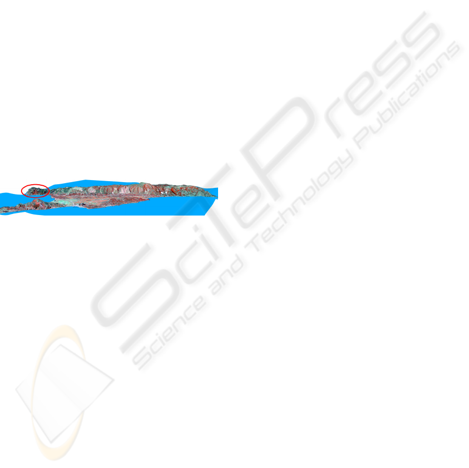
Figure 1: 3D representation of the study area.
The GIS was implemented using TNT mips
integrated GIS and Image Processing software
package and it is available to be distributed in CD,
info kiosks as well as through internet as WEBGIS.
In order to evaluate different geographical
information, the system uses a simple decision
making model. The information that is rated highest
by the decision making model are selected to be
presented by the system.
For this purpose a life-cycle framework have
been used for the incorporation of a multi-criteria
theory in ADAPTIGIS. This framework is called
MBIUI (Multi-criteria Based Intelligent User
Interface) life-cycle framework (Kabassi & Virvou
2006) and involves the description of a software life-
cycle that gives detailed information and guidelines
about the experiments that need to be conducted, the
design of the software, the selection of the right
decision making theory and the evaluation of the IUI
that incorporates a decision making theory.
During requirements capture, a prototype is
developed and the main requirements of the user
interface are specified. At this point the multi-
criteria decision making theory that seems most
promising for the particular application has to be
selected. This decision may be revised in the
procedural step of requirements capture in the phase
of construction.
During analysis, two different experiments are
conducted in order to select the criteria that are used
in the reasoning process of the human advisors as
well as their weights of importance. The
experiments should be carefully designed, since the
kind of participants as well as the methods selected
could eventually affect the whole design of the IUI.
Both experiments involve human experts in the
domain being reviewed.
The information collected during the two
experiments of the empirical study is further used
during the design phase of the system, where the
decision making theory that has been selected is
applied to the user interface. Further, the user
modelling component of the system as well as the
basic decision making mechanisms are developed.
As a result a new version of the IUI is developed
which incorporates fully the multi criteria decision
making theory.
3 REQUIREMENTS CAPTURE
During requirements capture the basic requirements
of the system are specified. For this purpose we
conducted an empirical study. For the purposes of
the empirical study a questionnaire was designed
and distributed to 299 users. The users were
randomly selected from different places in
Zakynthos as well as other parts of Greece.
6 human experts analysed the questionnaires
collected. Such an analysis provided information
about the possible categories of the users interacting
with the GIS, the interests and the knowledge of the
users belonging to each category for environmental
matters as well as for the Information and
Communication Technologies (ICT).
The analysis of the questionnaires revealed that
the potential users of the Web GIS could be divided
to five main categories. More specifically, 29% of
the users answering the questionnaires were
residents of the island (this category contained
pupils as well as people of different occupation but
not the residents working in a public authority). The
residents working in a public authority of the island
that answered the questionnaire corresponded to the
10% of all users participating the empirical study.
However, most of the users that answered the
questionnaire were tourists (42.5%). This was due to
SIGMAP 2008 - International Conference on Signal Processing and Multimedia Applications
394

the great touristic interest of the island. Additionally,
the environmentalists or researchers that participated
the study were just 2%. Finally, the empirical study
participated many students of the department of
ecology and the environment in the Technological
Educational Institution of the Ionian Islands, which
is located in Zakynthos (16.5%).
Furthermore, the analysis of the answers of the
subjects in the questions of the third part of the
questionnaire revealed what is more likely to interest
the users belonging in each one of the categories of
potential users, namely Residents, Tourists,
Environmentalists/Researchers, Public Authorities,
Students.
Finally, the analysis of the results revealed that
the computer skills of the tourists and the residents
of the island varied depending on the educational
level or the occupation of the person answering the
questionnaire. In view of the above, users could be
categorised into three categories taking into account
their computer skills. These categories should
correspond to high, medium and low level of
expertise in ICT.
4 ANALYSIS
According to MBIUI, during analysis, two different
experiments are conducted. The first experiment
aims at determining the criteria that are used in the
reasoning process of the human advisors and the
second aims at calculating their weights of
importance.
4.1 Specifying the Criteria
The six human experts that participated the
empirical study during requirements capture were
also asked about the criteria that human experts take
into account while evaluating alternative information
that would be appropriate and useful for a user.
These criteria are presented below:
• Degree of Interest (i): The values of this criterion
show how interesting information about
Zakynthos is for the users belonging to one
particular stereotype.
• Need for information (n): This criterion shows
how important information about Zakynthos is.
• Comprehensibility of the information(c): This
criterion shows how comprehensible each
information about Zakynthos is to the users
belonging to each stereotype.
• Level of computer skills (l): This criterion shows
how comprehensible the way of presentation of
each information about Zakynthos is to the users
belonging to each stereotype.
4.2 Determining the Weights of
Importance of the Criteria
The group of 6 human experts that selected the final
group of criteria also participated the experiment for
the estimation of the weights of importance of the
criteria. For this purpose, a scale from 1 to 4 was
proposed for rating the criteria. More specifically,
every one of the human experts was asked to assign
one score of the set of scores (1, 2, 3, 4) to each one
of the four criteria and not the same one to two
different criteria. The sum of scores of the elements
of the set of scores was 10. The scores assigned to
each criterion by each human expert were summed
up and then divided by the sum of scores of all
criteria (10*6 human experts = 60).
As a result, the weight for the degree of interest
(i) is
37.0
60
22
==
i
w
, the weight for the need for
information (n) is
30.0
60
18
==
n
w
, the weight for the
criterion of comprehensibility of information (c) is
20.0
60
12
==
c
w
and the weight for the criterion that
is related to the level of computer skills of the user
(l) is
13.0
60
8
==
l
w
.
5 DESIGN
During design, the user modelling component of the
system is designed and the decision making model is
adapted for the purposes of the particular domain.
Furthermore, the information collected during the
two experiments of the empirical study is further
used during the design phase of the system, where
the decision making theory that has been selected is
applied to the user interface.
After the calculation of weights was made, the
SAW method was used further for the calculation of
the multi-criteria function. According to the SAW
method the multi-criteria function is calculated as a
linear combination of the values of the four criteria
that had identified in the previous experiments:
SOFTWARE LIFE-CYCLE FOR AN ADAPTIVE GEOGRAPHICAL INFORMATION SYSTEM
395

ij
i
ij
cwXU
∑
=
=
4
1
)(
, where
i
w
are the weights
of criteria and
ij
c
are the values of the criteria for
the
j
X
theory topic.
In view of above the formula for the calculation
of the multi-criteria function is:
lcniXU
j
13.020.030.037.0)( +
+
+=
(1)
This function can be used for the evaluation of
information about Zakynthos and select the one that
seems to be the most appropriate for the particular
user. For this purpose, the values of the multi-
criteria function
)(
j
XU
should be calculated for
each theory topic, taking into account the values of
the criteria of the activated stereotypes. In this way,
an interaction with the system could be adapted to
each user by selecting different information for
different users.
6 IMPLEMENTATION
In view of the above, a Geographical Information
System was developed. The described GIS operates
over the Web and contains data about the physical
and anthropogenic environment of Zakynthos, an
island of Greece. The information that is maintained
in such a GIS would be of interest to a great variety
of users.
However, different kinds of users may have
different interests, needs and background
knowledge. In view of the above, the main
characteristic of ADAPTIGIS is that it can adapt its
interaction with each individual user. In order to
adapt the informatio4n provided to the interests and
background knowledge of each user interacting with
ADAPTIGIS, the system incorporates a user
modelling component. This component maintains
information about the interests, needs and
background knowledge of all categories of potential
users. The information that is collected for every
category of users has been based on the analysis of
the results of the empirical study.
7 CONCLUSIONS
In this paper we described the software life-cycle of
a knowledge-based GIS. The main characteristic of
the system is that it can adapt its interaction to each
user. For this purpose the system uses a simple
multi-criteria decision making model. However, for
the application of this model, different experimental
studies are required. Therefore, we used a general
software life-cycle framework which describes the
experimental studies that are required for the
application of any decision making model.
The application of the MBIUI framework
revealed that it seems rather effective for the design
and implementation of a GIS. In the particular GIS
the multi-criteria decision making is used for the
evaluation of different environmental data in
terms of some criteria that concern the user needs
and skills and select the one that seems most suitable
for a user.
ACKNOWLEDGEMENTS
The work presented in this paper has been funded by
the programme ‘ARCHIMEDES II’ (Operational
Programme for Education and Initial Vocational
Training - EPEAEK). The title of the project is
‘Adaptive Web Geographical Information System’.
REFERENCES
Choi D-Y (2007) Personalisation local internet in the
location-based mobile web search. Decision Support
Systems 43, 31-45.
Kabassi, K. & Virvou, M. (2006). A Knowledge-based
Software Life-Cycle Framework for the incorporation
of Multi-Criteria Analysis in Intelligent User
Interfaces. IEEE Transactions on Knowledge and Data
Engineering, 18(9), pp. 1-13.
Kabassi, K., Virvou, M., Tsihrintzis G., Kazantzis P.G.,
Papadatou Th. (2006). Adaptive Presentation of
Environmental Information in a GIS. Protection and
Restoration of the Environment VIII.
Rich, E. (1989) Stereotypes and User Modeling. In A.
Kobsa & W. Wahlster (eds.), User Models in Dialog
Systems 199-214.
Rich, E. (1999) Users are individuals: individuallizing
user models. International Journal of Human-
Computer Studies 51 323-338.
Malpica J.A., Alonso M.C., Sanz M.A. (2007) Dempster-
Shafer Theory in geographic information systems: A
survey. Expert Systems with Applications, 32, 47-55.
Virvou M. (2001). Software Engineering of
Environmental Computer-Assisted Learning.
Proceedings of the International Conference on
Ecological Protection of the Planet Earth, 2, 927-934.
SIGMAP 2008 - International Conference on Signal Processing and Multimedia Applications
396
